The advancements in computer technology have moved dramatically over the life time of a single generation. There are those in command of vessels who still recall their time as a young navigator using celestial navigation for ocean passages. Coastal passages used visual bearings and radar ranges, with the occasional assistance from Decca and Loran (early types of electronic navigation). However, no matter which modern aid was utilised, there were continuous checks and cross checks carried out to affirm the vessel’s position and to ensure the vessel was on her correct heading.
The start of the watch would include a check of the vessel’s position and cross check that the marked position on the chart was correct and that the planned courses for the watch had been properly laid off. Particular care was taken to assess the time of any alterations of course. Such alterations would generally be detailed in the Night Orders Book, with a requirement to call the Master who would attend on to the bridge. He would then check the vessel’s position before the alteration was executed. The vessel’s navigation was not carried out by the watch keeper, but by the bridge team, each checking on the other to ensure the safety of the vessel. The latest development in electronic navigation aid programs is ECDIS.
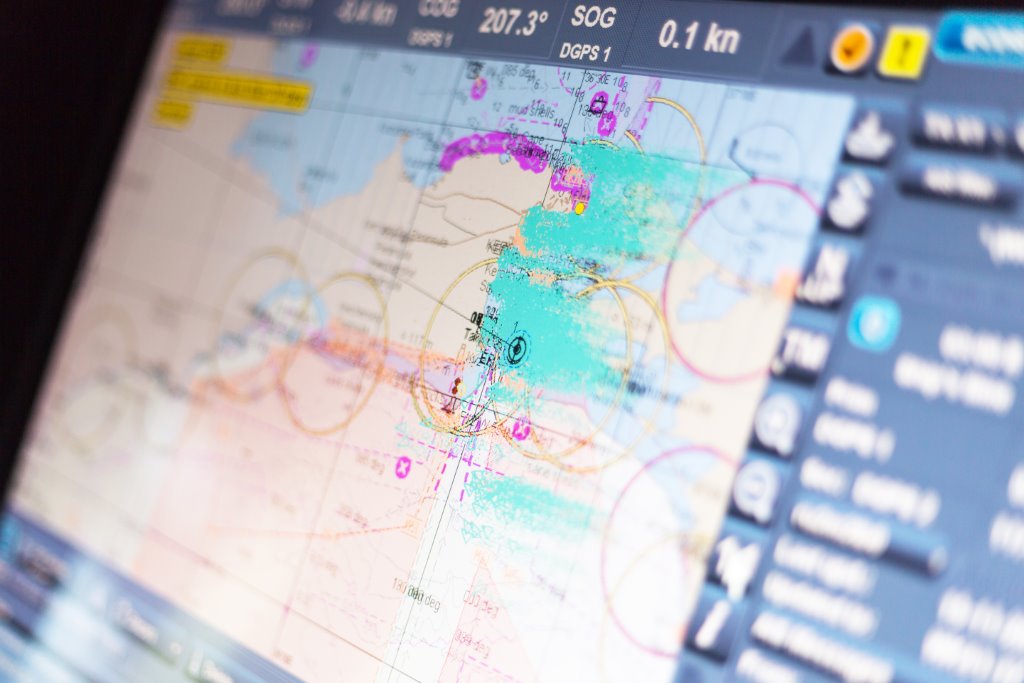
What is ECDIS?
Traditional paper charts have been replaced by the program Electronic Chart Display and Information System (“ECDIS”). Using this system the navigator of a vessel can now, with a touch of a button, easily change between charts and it will show the position of his own vessel and of vessels in the vicinity. The instant availability of the electronic chart saves time – no need to order and wait for paper charts. The Navigating Officer can also plan and summarise the passage much faster than on paper charts, the electronic charts are updated weekly, and are more cost efficient.
Considering The “MUROS” case
Recently, however, the UK Marine Accident Investigation Branch (“MAIB”) reported on the grounding of the bulk carrier, “MUROS”, on Haisborough Sand off the east coast of England.
Within their report, they drew on other casualties that had been investigated and highlighted ongoing research on why seafarers are utilising the ECDIS in ways that are often inconsistent with the system manufacturer’s instructions and guidance. In this article we delve deeper into why ECDIS is not being used as envisaged.
Time is of the essence
Time onboard is always at a premium, particularly when the vessel is trading on the coast with frequent port calls. The navigator has his watch keeping duties, on deck and on the bridge. In addition, they have to fit in passage planning/navigational preparations, hours of rest etc. If there is one job to be done with two methods, the quicker will prevail.
In the “MUROS” case, the navigator did a visual check of the passage on the ECDIS screen using a general scale (2) chart display to skim over the route that had just been planned. However, that check was not the same as running a ‘Route Check’ through the listed ‘warnings’. Of course the time that it would take to review upwards of 3,000 warnings makes one understand why a visual check was opted for, but raises a question as to the overall standard of the passage plan.
Such a shortcut had consequences, as the “MUROS” navigator discovered. The failure to zoom in and check on the largest scale vector chart resulted in relevant information not being displayed, with the consequence of the vessel’s course being incorrectly laid across the Haisborough Sand, where the vessel grounded.
The failure of all the alarms to sound on the intended passage also meant that the ECDIS safety alarms were not set. This meant that there was no alarm when the vessel crossed the safety depth or the safety contour. In days gone by, there was no such alarm system, save for when the cadet stood in front of the echo sounder and was told to shout when the 100 fathom line was crossed – so why is a depth alarm so important today? Is it because more is being left to the individual to do?
Using ECDIS has meant taking a back seat
The introduction of ECDIS appears to have caused the bridge team to take a back seat. Is this because once the ECDIS is programmed, it is ‘assumed’ to be correct? Is it because the Master is less familiar with computers and ECDIS than his junior officers who have been brought up in this age of gaming and electronics and are involved with the day to day operation of the ECDIS? This is a dangerous path since this is the same generation that do not easily question what they are being told by a computer. They have such confidence in the equipment that they do not doubt the information given to them.
ECDIS is an aid to navigation and it is the ‘aid’ part that today’s navigators frequently forget. They consider it to be the entire means of navigation, such that they do not need to cross check their positon as displayed, marking that range and bearing position on the ECDIS chart and then checking to see where the vessel is heading. The “MUROS” passed a number of buoys and passed them on the wrong side, yet no one checked for their light and position, and then to ensure that they were being passed on the correct side. The navigator is there to ensure they know where they are and where they are going.
With the reduction in manpower, today’s watch keepers appear to have been left to make their own decisions, with no backup checks. They can look at an electronic chart and watch the progress of their vessel as well as the progress of other vessels in the area. Rather than complying with the collision regulations, any vessel they consider in their way is more likely to get a VHF call, by name, to be asked what their intentions are – a practise frowned upon for decades, and still criticised, yet it continues. VHF and AIS assisted collisions have hit the headlines many times and are strongly criticised by the Court.
As in the “MUROS” grounding the phenomenon reported by the MAIB are commonly found in other groundings, attributed to improper use of ECDIS and its functions. For example:
a. Passage plans that have been completed, checked and approved are changed by the watch keeper after being asked to do so by the navigating officer in an effort to save a few miles.
b. The audible alarms are disabled for cross track error, look ahead functions, safety depth and safety contours resulting in no warning when these situations arise.
c. Failure to carry out a route check, in order to ‘clear’ all the alarms or ‘safety’ issues that the ECDIS has found in the planned passage. In the “MUROS” there was said to be around, an astonishing, 3,000 queries that should have been checked and cleared.
d. Working on the wrong chart type.
e. A failure to look out of the window, check the vessel’s position and that the intended course of the vessel is safe.
The Importance of Data Recording Equipment in Casualties
Like many incidents, it is never one event but a series, which causes a loss. The answers to the question as to why and how a vessel has run aground are usually tucked away in the VDR (voyage data recording). That is why systematic saving of data on the VDR is so important. Masters should be encouraged to save data whenever something untoward occurs on board the vessel. It would provide him and his officers with invaluable evidence of the events that occurred and hopefully prevent any reoccurrence. Fortunately for the “MUROS” navigator, the ECDIS voyage data was saved and accessed by the MAIB providing valuable insight into the incident.
AIS
The AIS data (Automatic Identification System) for the vessel transmits information of the vessel which includes her unique identification digits, position, course and speed. This information is received by shore stations and other vessels and is displayed on their AIS equipment and on their ECDIS program. It therefore allows watch keeping officers to track and monitor vessel movements. As with the VDR, the MAIB used AIS to cross check and confirm the credibility of the route information that had been downloaded from the VDR of the MUROS.
Some reflections and possible solutions
The ECDIS is an amazing aid, allowing one to view on a single screen how your vessel and other vessels in the vicinity are proceeding. However, route planning and checks using ECDIS requires time and if the navigator is not given adequate time to plan the passage, short cuts will be taken.
If the user of ECDIS is not fully conversant with the program or not confidant in its use, then he may not know how to run the necessary voyage checks to ensure his navigator has properly planned the passage. Whereas the Master could spot an error on a paper chart without difficulty, on ECDIS he has to know where to look.
Perhaps a new button needs to be installed, called the ‘MVC’, the Master’s Voyage Check, which runs a check of the current passage that is being monitored and lists not only safety issues but the alarm status and parameters.
Perhaps a full training day on specific courses on passage planning alone is required so that senior officers obtain adequate time to familiarise themselves with the controls needed to check that their navigators have properly planned the voyage. The navigators need time to become conversant with the safety checks they have to make before approving a passage plan.
Lastly, of note are the cautionary words from ECDIS Ltd in their training manual, a company that excels in training seafarers in the proper use of this equipment:
“There is a tendency to put too much trust in computer based systems and believe whatever is on the display. It is essential that officers remember to cross check the information displayed by all means available, especially by looking out the window and watching the radar.” (ECDIS Ltd IMO 1.27 Model ECDIS Course, JRC JAN-2000, V 1.6, 13 August 2012, page 64)